West Union Baptist Church Cemetery
Curryville, Gordon Co, GA

West Union Baptist Church
Cemetery, Curryville
West Union is a beautiful old church, established on 21 Jul 1848,
and located in the Curryville community of Gordon County. At least
20 Culpeppers are
buried at the church's well-kept cemetery, including the philanthropist, Charles Emory Culpeper.
To get there, from I-75
between Atlanta and Chattanooga, take Exit 130 (Calhoun and GA-156). Head west for about
12 miles on GA-156 through Calhoun. Turn right on Everett Springs Road. Preceding this
intersection (at least in 1998) was a pretty white rail fence for a quarter of a mile on
the right. There is also a sign for this same turn that points to the Hidden Creek
Recreation Area. The church will be found about 2.5 miles down Everett Springs Road, the
last building on the left before reaching the Floyd County line. 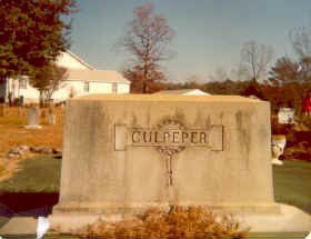
The monument above carries the rarely used 2-p spelling of
Culpeper. Apparently, this was in recognition of the cemetery's most notable occupant: Charles Emory Culpeper, who made a
fortune off Coca Cola bottling operations in New York and New Jersey during 1900-1940. The
monument is the family marker for the area with seven individuals within the Elam
Culpepper family. The family area is about 18' x 36', covered with dark green concrete,
the only such area in the cemetery. Within the area are markers for Elam and his wife
Phalba, plus their children. The marker for Charles Emory Culpeper is the only
individual Culpepper marker in the cemetery to use the 2-p version of the name.
Photograph taken in 1978 by James Burie
Clegg (1908-1990), a professional baseball umpire, and descendant of William Henry
Culpepper.
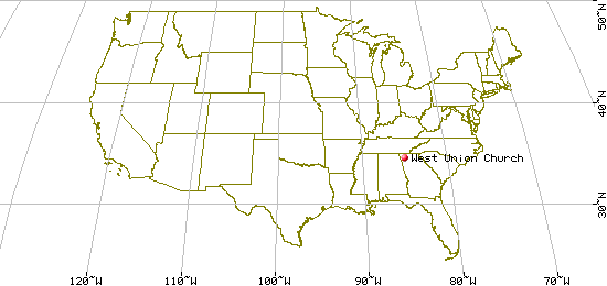
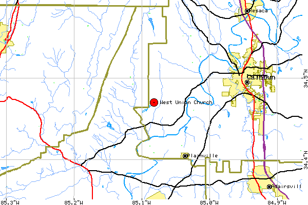
Driving Directions: The church and cemetery are
located in the Curryville community of Gordon County. To get there, from I-75 between
Atlanta and Chattanooga, take Exit 130 (Calhoun and GA-156). Head west for about 12 miles
on GA-156 through Calhoun. Turn right on Everett Springs Road. Preceding this intersection
(in 1998) was a pretty white rail fence for a quarter of a mile on the right. There was
also a sign for this same turn that points to the Hidden Creek Recreation Area. The church
will be found about 2.5 miles down Everett Springs Road, the last building on the left
before reaching the Floyd County line. Only 0.2 miles before reaching the church, on the
left is one of three sections of Culpepper Road that will be found in the area.
USGS 7.5' x 7.5' Map: Plainville
Latitude: 34.28.10 N
Longitude: 85.04.55 W
Last Revised:
02 Jan 2015
|
|
