|
Culpepper
Cannon County, Tennessee
Publisher's Note: According to Royce Culpepper,
the community of Culpepper (Cannon County), Tennessee no longer exists, although it still
appears on some maps. He drove down to Culpepper from Mt. Juliet on a rainy
day to check out this spot for his fellow Contributors at Culpepper Connections!
Following that trip, which included a visit to the Cannon County Library, he sent the
following article extracts and photograph.
 Culpepper
was located at the mouth of Locke’s Creek, four miles west of Woodbury on the
Murfreesboro-Woodbury Turnpike, now Highway U S 70 South. For long, it was the site of the
Readyville school. In stage coach days, it had a post station and, when Old Stage Road
became the Murfreesboro-Woodbury Turnpike, a toll booth. Culpepper
was located at the mouth of Locke’s Creek, four miles west of Woodbury on the
Murfreesboro-Woodbury Turnpike, now Highway U S 70 South. For long, it was the site of the
Readyville school. In stage coach days, it had a post station and, when Old Stage Road
became the Murfreesboro-Woodbury Turnpike, a toll booth.
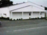
For years before 1930, the county Fourth of July picnic was held there. Today, only a
store (pictured, and now abandoned) is there, successor to the old Duggin store. The name Culpepper
was probably brought from Culpeper, Virginia, by Daniel Weedon’s family*, who lived
there in the early 1800s. The Virginia name Culpeper picked up an extra p in
Tennessee. The name is no longer used.
From: History of Cannon County, Tennessee, p. 236, by Robert L Mason, Published
by the Cannon County Historical Society.
* ...Gideon had chosen to concentrate his efforts on his land at the mouth of
Locke’s Creek, a place which came to be known as Culpepper (probably after
Culpeper, Virginia, by his son-in-law Daniel Weedon who came from there. He would increase
his acreage there to more than two thousand acres, including some of General Matthew
Locke’s original grant. Matthew Locke apparently never lived on or developed his
Stone’s River property, though some of his family may have.
Gideon probably found his Culpepper property advantageous for several reasons.
For one, it was on the Stone’s River Road built in 1806 and Stage Road, which
succeeded it, built in 1811. For another, It had river bottom land and potential water
power. Near the banks of the river, he built a two-story house, this time entirely of hewn
red cedar logs, with a central hallway, probably not then enclosed.
From: History of Woodbury and Cannon County, TN, p.
19, by Sterling Spurlock Brown, Doak Printing Company, Manchester, TN (1936)

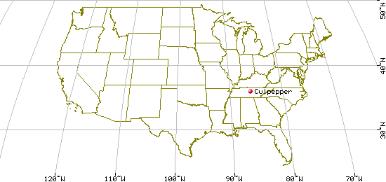
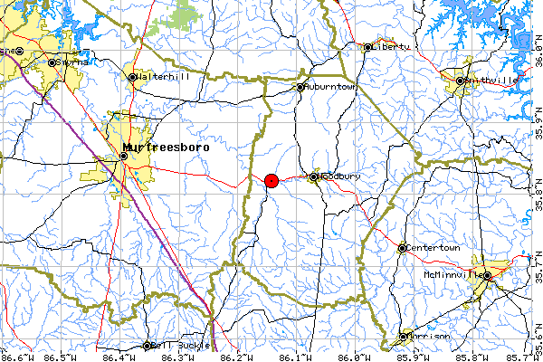
In Cannon County, 15 miles southeast of Murfreesboro on
US-70S.
| Elevation: |
640 |
| Variant Name(s) |
Braxton |
| USGS 7.5' x 7.5' Map: |
Readyville |
| Latitude: |
354906N |
| Longitude: |
0860834W |
Last Revised:
02 Jan 2015
|
