Ambrose Cowley, an English pirate made the first navigational charts
of the islands in 1684. At that time, he named the islands after fellow pirates, and for
English Kings (James, Charles), and for privateer-supportive noblemen (courtier of King
Charles II, John Culpepper appears to be the namesake of Isla Culpepper. Wenman is also
the surname of a contemporaneous nobleman in the court of Charles II). An tiny islet near
Isabella still bears the name Cowley.
The island of Chatham was likely named for the ship HMS Chatham
which visited the islands in 1795 along with HMS Discovery under the command of Captain
George Vancouver.

The following information is from a section of Cornell University's
web site on the Galapagos
archipelago. An additional historical
narrative is also available.

Discovery, Pirates, and Whalers
The Galapagos were discovered in 1535 by Fray Tomas de Berlanga, the
Bishop of Panama. This was the time of Spanish exploration and discovery, and followed
Magellan's circumnavigation of the globe by a just a dozen years and Balboa's discovery of
the Pacific by two dozen. de Berlanga, however, was no explorer. He had been sailing to
Peru, recently conquered by Pizzaro, when his ship became becalmed and was carried west by
currents; his discovery was entirely accidental. de Berlanga saw little value in the
islands. He wrote that the land there, inhabited only by birds, seals and reptiles, was
"dross, worthless, because it has not the power of raising a little grass, but only
some thistles." By the time de Berlanga sighted the first of islands, his ship had
only a two day supply of water. They found no fresh water on the first island they landed
on. They sailed on to a second (one with high peaks, possibly Santa Cruz) but ran out of
water by the time they reached it. After several days they succeeded in finding water
"in a ravine among rocks" (later visitors learned to find water by following
tortoise paths into the highlands). In the meantime, de Berlanga's men were reduced to
squeezing water from prickly pear cactus pads. Two men and ten horses died of thirst
before water was found. de Berlanga reported sighting two more large islands, possibly
Santiago and Isabella, and landed on the smaller of the two.
 In his report to the King of Spain, de Berlanga did not
refer to the islands by name, but they appear on Ortelius's 1570 world map as
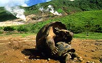
"Insulae de los Galopegos", named for the saddleback giant tortoises de Berlanga
and subsequent early visitors reported seeing.
It is possible that the islands were discovered some 60 years
earlier by the Inca king Tupac Yupanqui, as Incan oral history tells of his voyage to the
west and discovery of two "Islands of Fire". If there is truth to this, and
there are some inconsistencies in the story, it is perhaps more likely he discovered
Easter Island.
The fabulous wealth of the growing Spanish Empire caught the
attention of Spain's European rivals, who wanted to limit Spanish power and grab some of
the wealth for themselves. England in particular gave its blessing to pirates and
buccaneers who attacked Spanish galleons returning to Spain from the New World laden with
treasure. The Galapagos lay not far from the route between the conquered Inca Empire of
the Andes and Panama and New Spain (Mexico), the center of Spanish activity in the New
World. So beginning in the late 16th century, the Galapagos became a base of operations
for many English pirates. In 1684, one of these buccaneers, Ambrose Cowley, made the
first crude map of the islands and named each of them, mainly after English kings and
noblemen (these names have largely been supplanted by Spanish ones; a small islet east
of Isabel, however, still bears Cowley's name). Though fresh water is scarce in the
Galapagos, it can be found in a few localities. One particularly favored spot was
Buccaneer Cove on the northwest end of Santiago. Fresh meat, in the form of the giant
tortoises, was another valuable commodity to be had in the Galapagos. The giant tortoises
were highly prized by mariners because they could be kept alive in the holds of ships for
many months without food or water.
By 1790 pirates were being replaced by whalers. Captain James
Colnett was commissioned by His Majesty's government to investigate the possibilities of
sperm-whale fisheries in region and visited the islands in 1793 and 1794. Colnett made the
first reasonably accurate map of the archipelago and set up a "Post Office
Barrel" on Floreana. Whalers, who would be at sea for years, would leave letters in
the barrel and ships heading back to England to port would pick up the letters and deliver
them to port. The Post Office Barrel may still be seen today on the shore in Post Office
Bay.
Soon whalers from New Bedford as well as England were coming to the
Galapagos in large numbers, dozens of ships each year. Like the pirates before them,
whalers would hunt tortoises, turtles, birds, and occasionally land iguanas for food. The
whalers, though, were much more numerous than the pirates had been and some races of
tortoises quickly became extinct. As many as 200,000 tortoises may have been taken over
the course of the 19th century. Also taken in great numbers were fur seals, whose thick,
luxurious fur was highly prized. By the early 20th century they were nearly extinct (they
have since greatly recovered). In 1813, when the U.S., Britain, and France were at war
with one another, American Captain David Porter, commanding the U.S.S. Essex, nearly
destroyed the British whaling fleet in the Galapagos. At the same time, Porter charted the
islands and made careful observations of them in his log, including an eruption of
Floreana in July 1813, the only known historic eruption of this volcano. Porter was also
the first to remark upon the differences in the tortoises, particularly in the shape of
their shells, from the various islands. When anchored in James Bay, Porter released
several goats to graze near the shore. However, after several days the goats disappeared
into the interior and were not seen again. Porter had not intended to release the goats.
But in subsequent years and centuries, many were deliberately released to provide a
continuing source of meat to ships in the area. These goats would multiply, eventually
reaching 100,000 on Santiago, and devastate the native flora of Santiago and several other
islands and threatening the native herbivores, such as the giant tortoise. Today,
introduced species remain the single greatest threat to the Galapagos biota.

The
Dragons of Galapagos
© 1998 Australian
Broadcasting Corporation
 In May 1995 Australian film-makers David Parer, Elizabeth Parer-Cook and their
three year old daughter Zoe, arrived in Ecuador to make a film called "The Dragons of
Galapagos".
Over a two year period they spent 500 days in the field, 200 days of which were on
boats. Assisted by a guide, David Day and an Ecuadorian assistant Segundo Guaman, they
travelled to many islands of the archipelago including Espanola, Santiago, Floreana,
Isabela, Genovesa and the northern islands of Wenman and Culpepper.
 But the
bulk of their time was spent on Fernandina, the most active volcano in the region and home
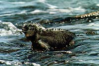
to vast numbers of marine and land iguanas - the so called "Dragons of
Galapagos".
To the casual observer the Galapagos has all the ingredients of a tropical paradise - a
string of Pacific islands on the Equator where the animals show no fear of man. Here
sealions frolic in the water only inches from anyone who ventures amongst them; finches
and mockingbirds land on your camera to peck at the lens cap and curious hawks hover only
feet above your head as you hike.
 But in reality the
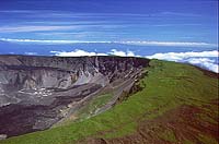
Galapagos is anything but a tropical paradise. It's a land of extremes - born of the
violence of volcanic eruptions. A place where rainfall is infrequent and the struggle for
existence and reproduction a battle. And a place that has its share of challenges for the
film-maker.